Drones – The Future Of Property Surveys
Drone Safe Register Partners with Leading Prop-tech Innovators InventoryBase
Innovation breeds disruption, and while not all disruption is good for everyone, Drones are growing in popularity as a means to significantly reduce the costs of aerial and elevated inspections that can otherwise cost thousands and take a lot of time.
A keen advocate of the use of drones; the property industry in recent years has seen the value of this option and has embraced the idea of aerial video and photography in order to help them find new ways to re-engage, incentivise and develop strategies for their client base.
Client retention in such uncertain times is key to moving forward, but can only really be achieved by delivering more value and throwing away ‘the box’ to think and develop beyond the property boundaries.
With proptech at the forefront of such innovation, everyone’s needs and wants can differ widely. One way to serve those needs when it comes to buying, renting, selling houses, land or buildings is the use of aerial photography and video to showcase properties whilst opening up the surrounding areas and breathtaking scenery to the keen eye of the digital world.
The use of unpiloted aircraft has increased exponentially in recent years as technology adapts to the demand for Remotely Piloted Air System (RPAS), Unmanned Air System (UAS) or as most of us know them; drones.
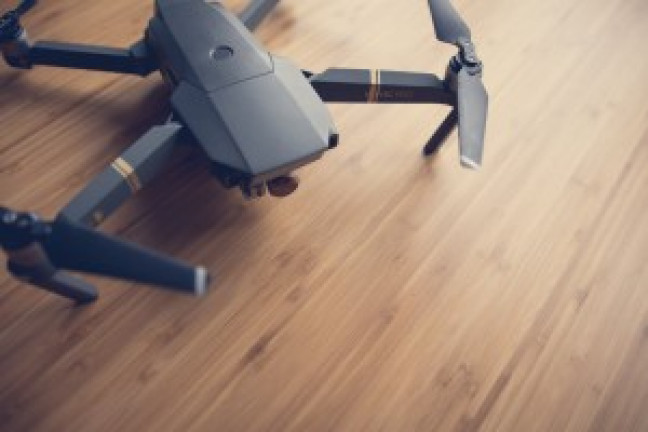
Drone Applications
In continuous development; drones are not just the hobbyists’ toys. They are now being more widely used for commercial purposes such as property surveys, roof inspections, search and rescue, geographical studies and films, to name just a few.
The 3 main types of drone are fixed-wing, single rotor and multi-rotor that can allow an experienced pilot a flight time of just a few hours up to 16 hours or more if gas-powered.
With the ability to reach high altitudes, carry weighted objects like parcels for Amazon Prime Air, hover over damaged rooftops or take detailed pictures of land being considered for development; the applications are endless.
Rules & Regulations for Drone use
Although increasingly popular, there are rules and regulations that must be adhered to when operating a drone.
Governed by the Civil Aviation Authority (CAA), if you are using a drone you must refer and adhere to the Air Navigation Order 2016, specifically Article 241 (endangering the safety of any person or property), Article 94 (small-unmanned aircraft) and Article 95 (small-unmanned surveillance aircraft).
This is the law and you can; and individuals have been, prosecuted for breaking it. You can read more by downloading the Drone Code from the CAA website.
Entering the Dragon’s Lair
Technology is a partnership that should enable and not disable. Rather than run the risk of fines and penalties for unauthorised, unsafe use of a drone to carry out reports, surveys or aerial video and photography Drone Safe Register caters for all types of drone work, but who is behind the register?
Founder Mark Boyt had already set up the Drone Safe Register when he decided to enter BBC 2 Dragons Den in 2018. Looking to increase awareness and safety in the marketplace. Mark walked into the den with excited anticipation, being so nervous he hadn’t slept the night before. Once the demonstration was over the pitch was ‘relatively simple.
With 3 dragons all-vying for a stake in the company and a heated exchange between the internationally known business owners; Peter Jones, CBE was the eventual victor. Watch the moment Mark clinches the deal; BBC Dragons Den.
How does the property industry benefit from the use of drones?
With the need for remote viewings and instant digital information; practically all property transactions now start online. And with restrictions of movement likely to be in place for some time; viewing a property needs to be more than just 2D.
Aerial Photography provides the viewer with unparalleled access to all corners of the property; every angle captured not just for that one visit but for the benefit of thousands of potential buyers that browse Rightmove, Zoopla and On The Market every day for their next treasured home.
It’s not just photography that we as consumers are interested in; Aerial Videos are the ‘new kid on the block’ when it comes to viewing not only the house but also the property boundaries and surrounding areas.
With the potential to reach up to 400 feet, the views can be breathtaking as well as informative.
The use of drones goes so much further than marketing a property for sale. Increasingly, drones are being used to inspect the property (both residential and commercial) for issues, defects, damage and flooding as a result of our increasingly unpredictable weather; as we’ve recently experienced during Storm Alex.
Roof Inspections are a vital part of a survey and aerial data can play a large part in establishing the extent of damage to property.
There is a real need to incorporate the use of drones into surveyor’s services. Informing the mapping and planning process, boundary disputes and mortgage applications, surveyors are now looking for drones to help inform and deliver their reports.
In partnership with InventoryBase, Drone Safe Register has a unique offer available exclusively through InventoryBase’ system, Workstreams.
Our partnership allows InventoryBase customers to access and book a Certified Licensed Pilot from Drone Safe Registers’ comprehensive membership list and UK wide licensed UAV pilots.
This will enable more and more people to experience stunning aerial photography, wow clients with unparalleled video access to the property and safeguard against damages and disputes with aerial video.
We are really looking forward to seeing what we can achieve together with our combined forces of advanced technology.


